I figured this photo wouldn’t take Thomas very long to identify because there were two proper names for him to Google, but I was interested to find out what he could learn about the ships in the process. Two days after I sent the photo, I got an email from Thomas’s mom (she helps him write to me):
Thomas wants to know if you had coffee in the cafe Kathrina (three-masted schooner) while it was docked/stuck in ice in the winter in Helsinki, Finland. He also wants to know if you rode the Silja Line and if so was it to Tallinn or Aland or Stockholm.
So I wrote Thomas back:
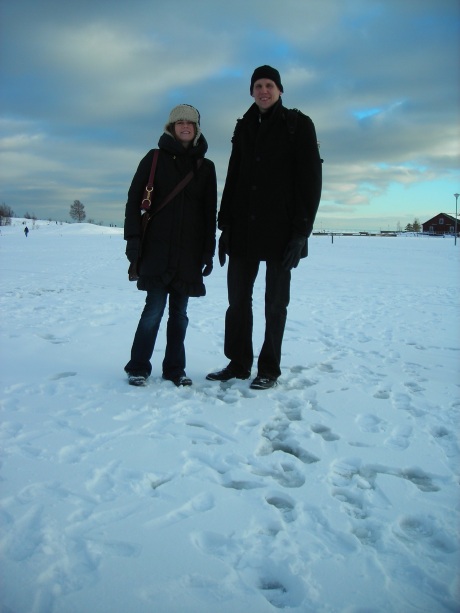
I never had coffee on that cafe boat, but once Graham and I had a beer on a “bar boat” docked nearby. We did ride the Silja Line—from Stockholm to Helsinki. The ferry takes all night—you board around 5:00 pm and you get a tiny little cabin with two twin beds that fold up against the wall. The boat has a fancy all-you-can-eat buffet dinner, and then you can either sing karaoke or listen to a band play dance music. You wake up in the morning just in time to watch the boat dock in Helsinki harbor. When I first arrived in Helsinki, it was early March and the harbor was so frozen solid that you could go out and walk across it to reach the islands. I am attaching a photo of me standing on the ice in the middle of the harbor with my Finnish friend Riku. The island behind us is Liuskasaari. Saari means island in Finnish.

Then I got another email from Thomas’s mom, explaining the details of his investigation:
He started by saying that it must be in the north because of the snow and ice. He knows about seasons/hemispheres, but I reminded him that you could have been to South Georgia (i.e., near the South Pole) and also that we didn’t know when you had taken the photo. He then Googled “types of boats” and after looking at the image results realized that boat wasn’t the right word. I suggested “ship.” That was the right term, but the results were not helpful (although the boat/ship distinction was interesting).
He searched on the Silja name, which led him to their website and a map of their routes. He was stuck at this point for a while—looking at the route map and Google map of the area. He could read “Helsinki” on the schooner, and we decided to try to see if the photo was taken in Helsinki. He followed the ship routes on Google maps into the harbor of Helsinki. He could see two or more ships of the same size and moved around until he found Silja Terminal on the map.
We talked about angles and he found the area where he thought you had taken the picture. He pulled the “little man” on Google maps down to the spot he thought was right (the little man is an important part of this process for him, but I’m not sure when/how he learned how to use it). He tried a couple of different spots. He finally found a photo of the cafe boat, which felt to both of us like confirmation. We woot and holler when we think we’re right, so this was that moment.
He searched on the name of the cafe boat, which he had been unable to read from your photo but could read on the photo he found online. We found a blog that had a lovely description of the boat and the blog writer’s experience on the boat, which made Thomas wonder if you had coffee there.
60.169845
24.938551


